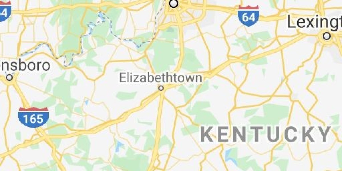

Looking at the Kentucky Bourbon Trail map for the first time can be deceptive. What appears on your phone screen as a compact cluster of pins actually covers hundreds of square miles of rolling farmland, river valleys, and bustling cities.
Without a clear understanding of the geographic layout, visitors often spend four or five hours a day stuck in traffic on rural highways rather than relaxing in tasting rooms.
Here is a practical breakdown of how the Kentucky Bourbon Trail map is structured, how to navigate between regions, and how to build a smooth, efficient travel route.
The Bourbon Triangle: How the Map Connects
The Kentucky Bourbon Trail is not a single loop. Instead, think of it as a large triangle anchored by three major points: Louisville to the northwest, Lexington to the east, and Bardstown to the south. In the center of this triangle lies the Frankfort and Versailles corridor.
- Driving between Louisville and Bardstown takes roughly 50 minutes heading south.
- Driving between Louisville and Frankfort takes approximately 55 minutes heading east.
- Traveling between Bardstown and Frankfort requires about 55 minutes across rural highways.
- Driving between Frankfort and Lexington takes 30 minutes.
To build a smooth itinerary, dedicate each day of your trip to a single corridor rather than crossing back and forth across the center of the triangle.
Detailed Breakdown of the Main Corridors
Corridor 1: The Louisville Metro and Whiskey Row
- Primary Distilleries: Old Forester, Michter’s Fort Nelson, Angel’s Envy, Evan Williams, Rabbit Hole, Kentucky Peerless, and Stitzel-Weller.
- Transit Times: 5 to 15 minutes between locations within the city.
- Map Strategy: This is the most walkable and transit-friendly corridor on the map, allowing you to visit multiple world-class facilities along Main Street without needing a car.
Corridor 2: The Bardstown Heritage Loop
- Primary Distilleries: Heaven Hill, Willett, Bardstown Bourbon Company, Barton 1792, Lux Row, Preservation, and Maker’s Mark (located thirty minutes south in Loretto).
- Transit Times: 10 to 15 minutes between distilleries around Bardstown; 30 minutes south to Maker's Mark.
- Map Strategy: Ideal for a full-day country excursion from Louisville by taking Interstate 65 South to the Bluegrass Parkway.
Corridor 3: The Frankfort and Versailles River Corridor
- Primary Distilleries: Buffalo Trace, Castle & Key, Glenns Creek, and Woodford Reserve.
- Transit Times: 15 to 25 minutes between stops along the scenic Kentucky River valley and McCracken Pike.
- Map Strategy: Known for dramatic stone architecture and horse country vistas. Roads are narrow and winding, so build in extra driving buffers.
Corridor 4: The Lexington and Lawrenceburg Trail
- Primary Distilleries: Wild Turkey, Four Roses, Town Branch, James E. Pepper, and Barrel House.
- Transit Times: Lawrenceburg sits roughly 20 minutes west of Lexington; downtown Lexington distilleries sit 5 to 10 minutes apart.
- Map Strategy: Pair morning heritage tours in Lawrenceburg with an afternoon visit to Lexington’s lively historic Distillery District.
Realistic Drive-Time Reference Guide
· Downtown Louisville to Bardstown: 45 to 55 minutes
· Downtown Louisville to Frankfort: 50 to 60 minutes
· Bardstown to Versailles: 55 to 65 minutes
· Frankfort to Lexington: 30 to 40 minutes
· Bardstown to Maker’s Mark (Loretto): 25 to 35 minutes
· Buffalo Trace (Frankfort) to Castle & Key (Millville): 20 to 25 minutes
Three Navigation Pitfalls GPS Won't Warn You About
1. Rural Cellular Dead Zones
When driving along the river valleys outside Frankfort, Versailles, and Loretto, cell phone signals frequently drop out. If you rely entirely on streaming navigation, you risk losing your route between stops. Download offline maps for Nelson, Woodford, and Franklin counties before leaving your hotel in the morning.
2. Slow-Moving Farm Machinery
During spring planting and autumn harvest seasons, tractors, grain trucks, and horse trailers frequently travel along rural two-lane highways. A drive that shows as twenty minutes on navigation can easily take thirty-five minutes behind slow farm equipment. Always add a fifteen-minute cushion to your travel estimates.
3. State Time Zone Boundaries
The vast majority of the Bourbon Trail operates in the Eastern Time Zone. However, if your trip takes you west toward Owensboro for Green River Distilling or Bowling Green, you will cross into Central Time. Always verify the local time zone on your tour confirmation tickets so you do not arrive an hour late.
A Sample Three-Day Geographic Route
· Day 1: Louisville Urban Trail: Start at 10:00 AM with the Old Forester production tour on Whiskey Row. Walk over to NuLu for lunch at 12:30 PM. Visit Rabbit Hole Distillery at 2:00 PM, and wrap up with vintage cocktails at Michter’s The Bar at Fort Nelson at 4:30 PM.
· Day 2: Bardstown Heritage Loop: Depart Louisville at 8:30 AM to arrive at Heaven Hill for a 9:30 AM tour. Enjoy lunch at the Bardstown Bourbon Company Kitchen at noon. Visit Willett Distillery at 2:00 PM, and finish at Lux Row Distillers at 4:00 PM.
· Day 3: Frankfort & Versailles River Corridor: Arrive at Woodford Reserve in Versailles for a 9:30 AM morning tour. Enjoy lunch in the historic railroad town of Midway at noon. Tour Castle & Key Distillery at 2:00 PM, and conclude with a late afternoon tasting at Buffalo Trace in Frankfort.
Navigate the Trail Without the Headache!
Navigating unfamiliar rural backroads, calculating driving buffers, and giving up tastings to serve as the designated driver can quickly drain the fun from your trip.
With Sip Kentucky, you can leave the map behind and experience Kentucky Bourbon Country in complete comfort. Traveling in a luxury Mercedes Sprinter van with a knowledgeable local chauffeur, your group will arrive at every tasting relaxed and on time. Let Sip Kentucky handle the driving while you enjoy the journey.